Partial list of funded projects (**) performed by Altostratus Inc. for the following clients and funding agencies. For technical information or additional details, see the Publications and Research pages or send us a query (see Contacts page).
** Several projects with non-disclosure agreements are not listed here -- they will be included in the future.
CALTRANS / Sacramento Metropolitan Air Quality Management District (SMAQMD)
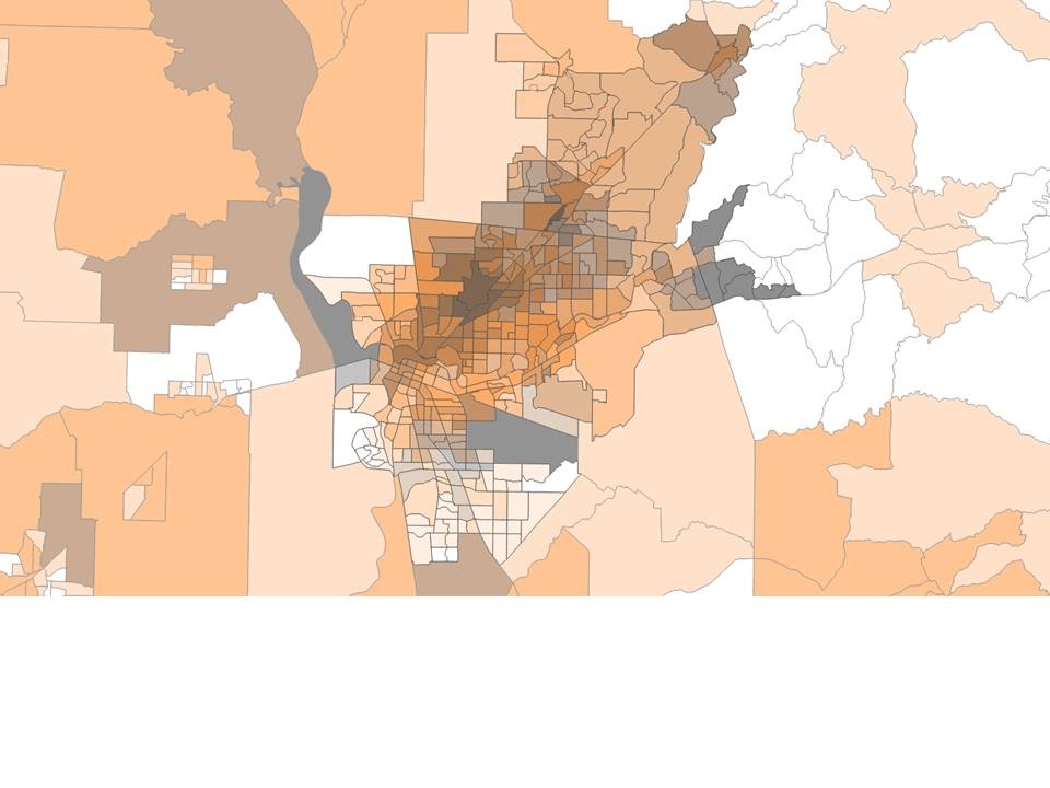
Advanced atmospheric modeling for the development of a regional heat mitigation plan for the 6-counties Capital area (Greater Sacramento Valley). Various current- and future-climate scenarios of transportation- and non-transportation heat-mitigation measures are modeled and evaluated in terms of impacts on urban weather, thermal environment, infrastructure, and intra-urban climate variability in the area. The modeling is based on a specifically-tailored, Altostratus-modified version of uWRF and area-specific high-resolution bottom-up characterization of land use and urban morphology. The project also uses observational meteorology from fine-resolution mesonet networks in the region. For more information, see the  Project Technical Report.
| |
Climate Resolve / Council for Watershed Health
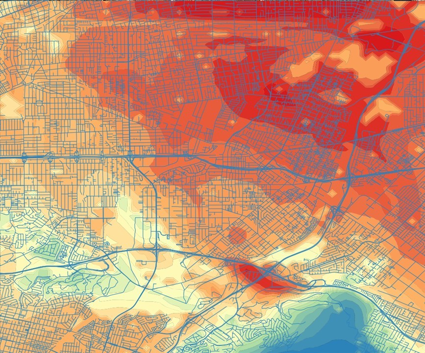
In a project funded and led by the Council for Watershed Health and Climate Resolve for the City of South El Monte, California, Altostratus applies advanced atmospheric modeling techniques to carry out fine-scale (down to 50 m horizontal resolution) prognostic micrometeorological modeling of selected urban-cooling and watershed measures that are installed (or to be installed) as part of the Merced Avenue Greenway Project. High-resolution satellite data are also used to characterize various properties of the surface such as urban geometrical / morphological characteristics, thermophysical properties, and land cover. The study set out to characterize the urban-canopy and boundary-layer thermal environment and then quantify the impacts and benefits of potential measures such as cool pavements, cool roofs, cool walls, porous pavers, and fleet electrification in reducing urban overheating and local heat islands. The main project element currently implemented is the planting of over 100 trees along the southern part of Merced Avenue. The modeling approach is designed to capture these local effects, including cooling, at various stages of canopy-cover growth through maturity. These impacts are also tracked from remote-sensing platforms. Results from this work will provide the City of South El Monte with information as to the effectiveness and potential ranking of cooling measures in the vicinity of Merced Avenue as well their effects if implemented city-wide. The study will also quantify changes in the heat-island index and heat-health indicators resulting from various urban-cooling measures in this area.
| |
GAF
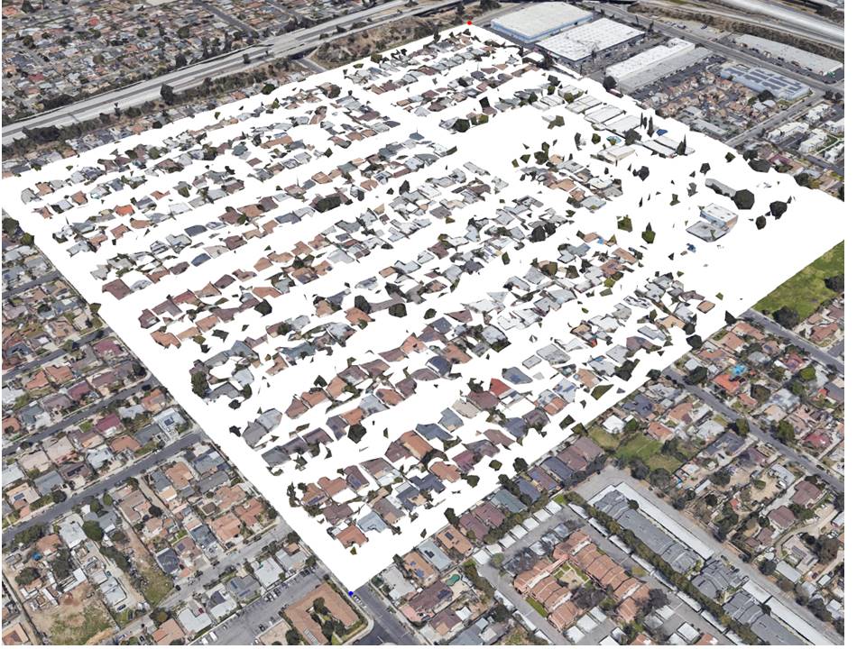
In this project, funded and led by  GAF, Altostratus is tasked with developing and executing a multi-scale, multi-platform monitoring plan for surface and micrometeorological characterizations using data from remote-sensing platforms (satellite and aircraft) and urban boundary-layer observations (project-specific and mesonet weather stations), designing and implementing a mobile platform for canopy-layer micrometeorological measurements, and carrying out advanced, high-resolution atmospheric modeling with techniques and parameterizations developed and updated at Altostratus. Synthesizing information from these sources, the goal is to quantify on- and off-streets radiative, thermal/environmental, and micrometeorological effects and benefits of community-wide implementation of StreetBond's (R) cool-pavement coatings in an area in the San Fernando Valley, California. Their potential to offset some of the local urban heat island index (UHII) are also quantified. Test and reference areas (communities) are compared to further evaluate these effects under various weather conditions. A story about the project can be found
  here.
here.
| |
California Energy Commission (CEC)
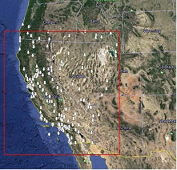
Intra-urban enhancements to long-term probabilistic and short-term deterministic weather forecasts for the electric system in California. The goal is to reduce uncertainty in local climate forecasts by improving the representation of urban canopy- and boundary-layer processes in the WRF meteorological model and developing transfer functions for use in load forecasting. Accounting for intra-urban variations in climate, via ensemble modeling, can provide utilities and system operators with information for more accurately allocating resources and distributed generation. The intra-urban climate variations are characterized for current conditions (current climate) as well as decadal time intervals into the future through 2100. For future years, the study not only accounts for potential changes in climate (via dynamical downscaling of global climate models) but also changes in land use and land cover. The study examines coastal and inland/valley areas in California. The project report  can be accessed here, at the California Energy Commission.
| |
Lawrence Berkeley National Laboratory / California Energy Commission (CEC)
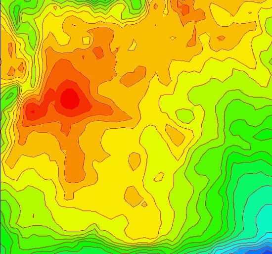
As part of the Fourth California Climate Change Assessment (CCCA4), this project involved real-world monitoring and modeling of the urban heat island (UHI) in California. Focusing on the Los Angeles urban-climate archipelago, fine-resolution micro-meteorological modeling (with Altostratus' mod-uWRF) was performed to assist in siting new weather monitors for multi-year characterization of the UHI and to design routes for mobile measurements. Mobile transect observations were carried out to fill in the information gap among the new fixed monitors and the mesonet stations that are already in the region. Observational UHI data were used to fine-tune model parameterizations and incorporate observations into simulating the Los Angeles UHI for improved site specificity. The methods developed in this project can be applied elsewhere to observe the UHI and characterize its spatio-temporal patterns. For more information, see the  CCCA4 Report or the
  paper in Climate.
| |
California Environmental Protection Agency (CalEPA) / California Air Resources Board
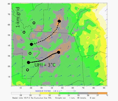
Altostratus Inc. developed a  first-of-its-kind Urban Heat Island Index (UHII) for the State of California. The UHII was computed based on fine-scale meteorological modeling with the Altostratus uWRF model that incorporates updated parameterizations and surface characterizations. At each census tract, the UHII calculations not only accounts for the localized heat island effect (UHI), but also heat that is transported from upstream sources. Thus, time-dependent and space-varying upwind UHI reference points were used in computing the UHII -- the goal was to avoid contaminating the UHII signal with heat transported to those non-urban reference points. The UHII characterizes existing microclimate conditions and is intended as additional information for possible use with the CalEnviroScreen tool. For more information, visit the CalEPA
  interactive maps, the Altostratus
  project technical report, or the
  scientific paper.
| |

American Public Health Association (APHA)
Waverley Street Foundation / Smart Surfaces Coalition (SSC)
| |
California Energy Commission (CEC)
A two-part project. Part 1: Multi-year, multi-seasonal modeling of potential meteorological and air-quality impacts of urban heat island control in California. Mesoscale and meso-urban (fine-resolution) meteorological, emissions, and photochemical modeling (MM5, uMM5, CAMx) was done to evaluate impacts on ground-level ozone, both positive and negative. Extensive photochemical modeling was also done, with step-wise NOx and VOC control, to develop anthropogenic emission-equivalents to changes in ozone concentrations. For more information, see  scientific paper in Sustainable Cities & Society. Part 2: Fine-resolution micro-meteorological modeling for quantification of the atmospheric impacts of large-scale deployment of solar arrays (photovoltaic and solar thermal systems) in urban areas. For additional information, see
  scientific paper in Solar Energy.
| |

Sacramento Metropolitan Air Quality Management District (SMAQMD)
Meteorological, emissions, and photochemical modeling for the development of a SIP control strategy (urban forest measure) for the Sacramento Federal Non-Attainment Area (SFNA). Control measure for ozone was evaluated with innovative multi-scale modeling (integrated mesoscale and meso-urban, fine-resolution models), more accurate surface characterizations and representations, and state-of-science emissions calculations. The project evaluated the atmospheric effects of changes in canopy structure/cover, species makeup and varying BVOC emission rates, as well as future impacts of business-as-usual scenarios and controlled changes in canopy cover. For additional information, see  scientific paper.
| |

San Francisco International Airport (SFO) / Smart Surfaces Coalition (SSC)
Highly site-specific and fine-scale micrometeorological and environmental modeling of various surface modifications in and around the SFO campus. Modeling carried out down to 100 m and 50 m resolutions (using Altostratus’s modified WRF urban parameterizations and input techniques) to evaluate measures that include ground-level and elevated increases in albedo (e.g., roofs, parking lots, aprons, runways, taxiways, roadways, and other surfaces) while minimizing any potential glare effects. Additional measures include solar PV and green ground cover such as bioswales. Evaluation of the effects on local (campus-wide) micrometeorology and potential downwind implications of cooling measures and the potential for mitigating the local CalEPA UHI Index at campus or census-tract scales under current and future climates. High-resolution outdoor thermal-environmental and thermal-comfort assessments using quantitative metrics.
| |

California Energy Commission (CEC)
Meteorological and micro-meteorological modeling and analysis of the atmospheric impacts of community-scale environmental and energy technologies. Based on modeling and data generated in this project, a tool can be developed to prioritize and rank various environmental technologies based on their indirect atmospheric effects alone and in combinations (feedback among effects of various technologies) and, thus, to maximize the energy/environmental benefits from their deployment in California. The project modeled California's 16 building-energy climate zones as well as an additional 180 micro-climate sub-zones (urban areas) defined in the project. For a summary, see the publications list.
| |

U.S. Environmental Protection Agency (US EPA)
Meteorological modeling of heat-wave events in the U.S. and analysis of heat-wave impacts (heat index) in several regions (e.g., Chicago IL, Houston-Galveston TX, New York NY, Baltimore MD, Los Angeles CA). Based on comprehensive modeling, the potentials for mitigation at the local scale with urban cooling are also evaluated.
| |

National Science Foundation (NSF)
Project "FUSE", Bio-complexity in the Environment Initiative; Develop a modeling framework to evaluate and quantify interactions and feedbacks among meteorology, air pollution, energy consumption, and human response. The study involved 1) detailed emissions and photochemical modeling and linkages to meteorological and health models and 2) the development of a modeling framework for representation of chemistry-to-meteorology feedback (via radiative transfer modeling). The framework was applied to two regions in the U.S.; Portland OR (CMAQ-MM5) and Houston TX (CAMx-MM5). For more information, see  scientific paper.
| |

National Aeronautics and Space Administration (NASA)
Convective enhancement and precipitation: Evaluation of the skills of different meso-urban model formulations (in UCP MM5 and uMM5 models) in reproducing precipitation events in Texas. Modeling is carried out with updated boundary layer / urban canopy layer parameterizations; Fine-resolution modeling and evaluation of the impacts of urbanization on precipitation in the Houston-Galveston-Brazoria region. See list of publications.
| |

Lawrence Berkeley National Laboratory (LBNL)
Modeling of urban climates, urban heat islands, and impacts on ozone and particulate-matter air quality; Evaluation of the potential impacts of urban heat island mitigation strategies on air quality in India.
| |


MacArthur Foundation
Smart Surfaces Coalition (SSC) / The Energy and Resources Institute (TERI)
| |
California Energy Commission (CEC)
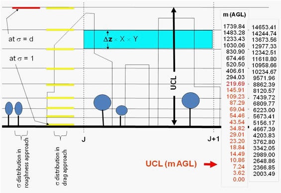
Model development / new-generation fine-resolution "urbanized" mesoscale meteorological modeling; Development and use of fine-resolution 3-dimensional urban morphological parameters; Application of the urbanized MM5 (uMM5) model in fine-resolution (1-km) emissions and photochemical (CAMx) modeling of the potential impacts of surface modifications on ozone air quality in California. For additional information, see the  scientific paper.
| |

San Jose State University Foundation (SJSUF) / Department of Meteorology
Update and application of the urbanized MM5 (uMM5) in meteorological and dispersion modeling of the New York / U.S. Northeast region in support of San Jose State University's participation in the Department of Homeland Security's New York City Urban Dispersion Program (UDP).
| |
Natural Resources Defense Council (NRDC)
Dynamical downscaling of global climate / general circulation model (AOGCM) output; Mesoscale (regional) meteorological and photochemical/air-quality modeling of California under future-year climate scenarios; Modeling and analysis of impacts of several IPCC TAR climate-change and emission scenarios (SRES) on urban ozone and air quality in California.
| |

Houston Advanced Research Center (HARC)
Development, testing, and application of new meteorological-model parameterizations of the urban canopy layer for site-specific modeling. Application of a UCP version of the PSU/NCAR MM5 in modeling the Texas-2000 SIP episode with focus on the Houston-Galveston region for mitigation studies including emissions control and urban cooling. For more information, see  scientific paper.
| |

California Energy Commission (CEC)
Modeling the regional impacts of large-scale urban surface modifications on meteorology, emissions, and ozone air quality. Meteorological and photochemical model updates and application to western U.S. and California in particular, focusing on the Sacramento Valley, San Francisco Bay Area, north and south San Joaquin Valley, the Los Angeles Basin, and the San Diego area.
